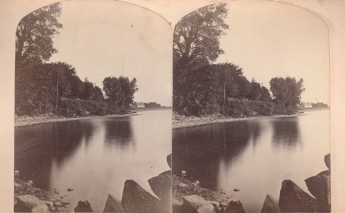
In my ongoing quest to gather and showcase vintage artifacts from our fair hamlet, I often come across images and other items that stump me. The vintage stereoview in this post is one such example. We’ve shared it on the Essex on Lake Champlain community blog in the hopes of crowd-sleuthing the whereabouts. Our understanding was that this sliver of an Essex harbor was once known as Blood’s Bay. But that’s far from certain…
Here’s what we offered our neighbors by way of brainstorming invitation.
I have read that this northern Essex harbor was once-upon-a-time referred to as Blood’s Bay or some such similarly sanguine moniker. Do you know of any other names this bay has been called throughout the years? (Source: Essex on Lake Champlain)
And here’s how two of our neighbors responded.
Steve Mckenna: Whallons bay.
Mark Kupperman: Second vote for Whallon’s bay, from what used to be the town beach? Is that building part of original Barracks?
George Davis: Or perhaps a bit further north?
Steve Mckenna: Ha! That was my second [guess] (Source: Essex on Lake Champlain)
Perhaps they are right. Perhaps the image was made near where the intersection of Albee Road and Lakeshore Road. But I’m not certain. And at the risk of perpetuating a falshood (and in the hopes of soliciting more learned feedback), I’d like to reword my thoughts from the original post on our Essex community blog.
Given other historic photographs from early in the 20th century it appears that the timbers in the foreground of this stereoview were part of a “crib dock” pier near the present day Essex-Charlotte ferry dock, and the “barn” in the distance was most likely located near Sandy Point. Or possibly on the now defunct crib dock north of — and parallel to — Rosslyn’s boathouse? This is more apparent in another stereroview shot from the opposite perspective which we’ll share online soon. (Source: Essex on Lake Champlain)
What do you think? Any idea what we’re looking at?
What do you think?